|
|
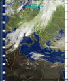
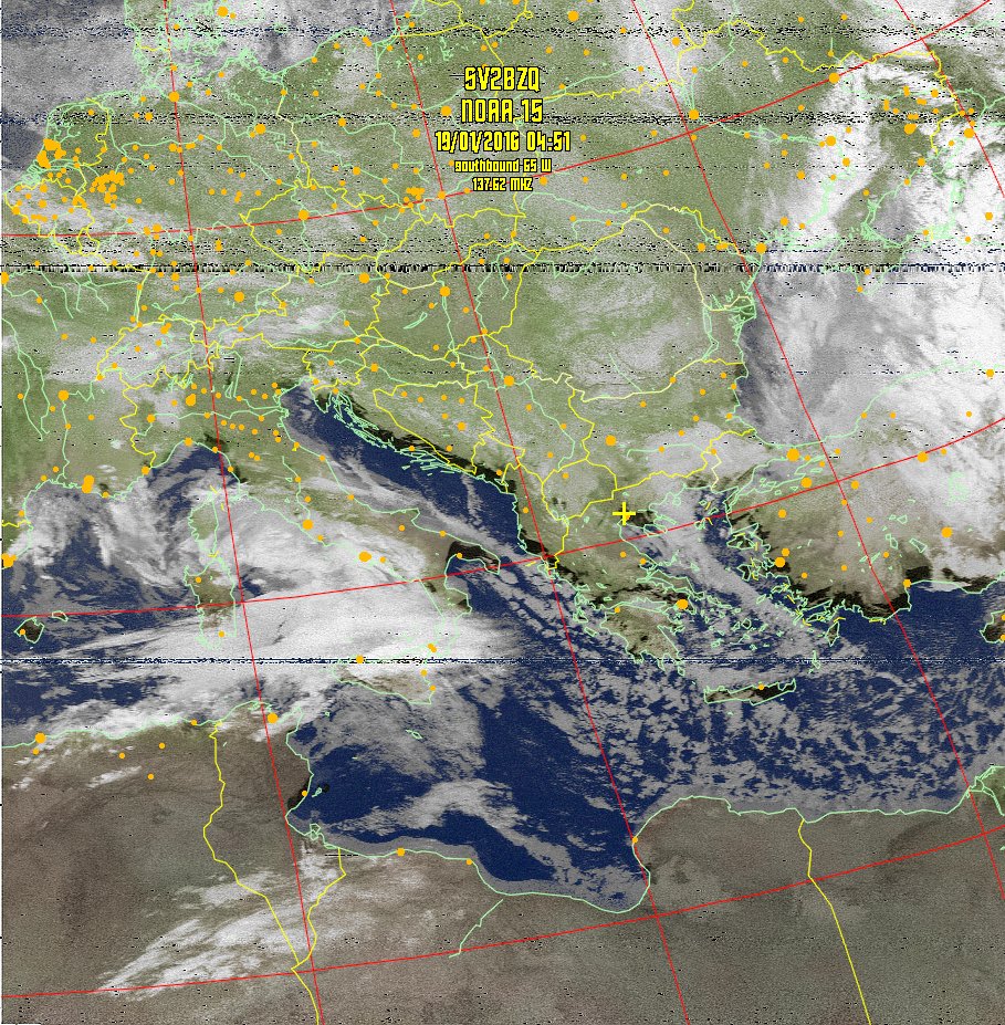
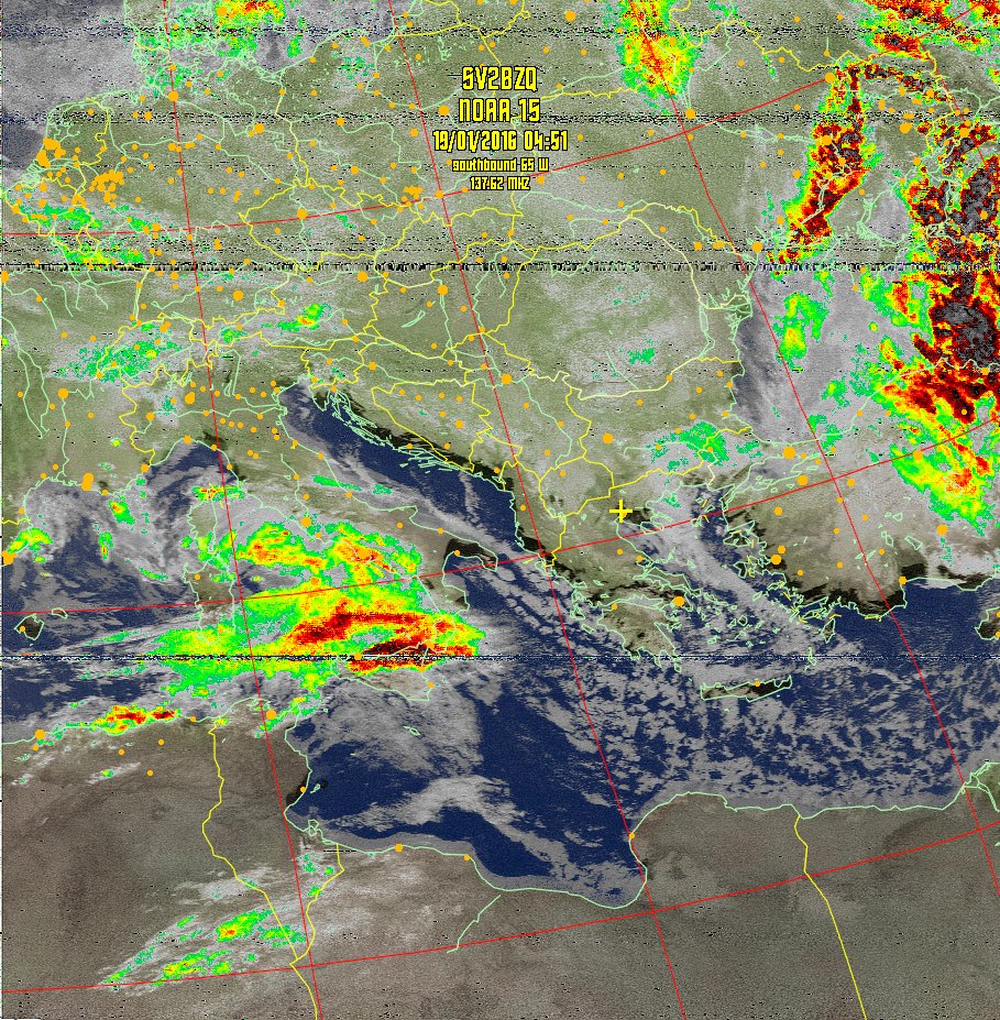
Daily Weather Satellite Images received in
|
 |
|
|
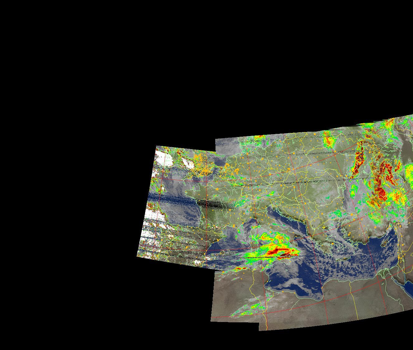
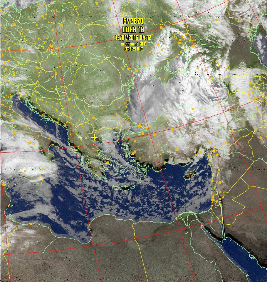
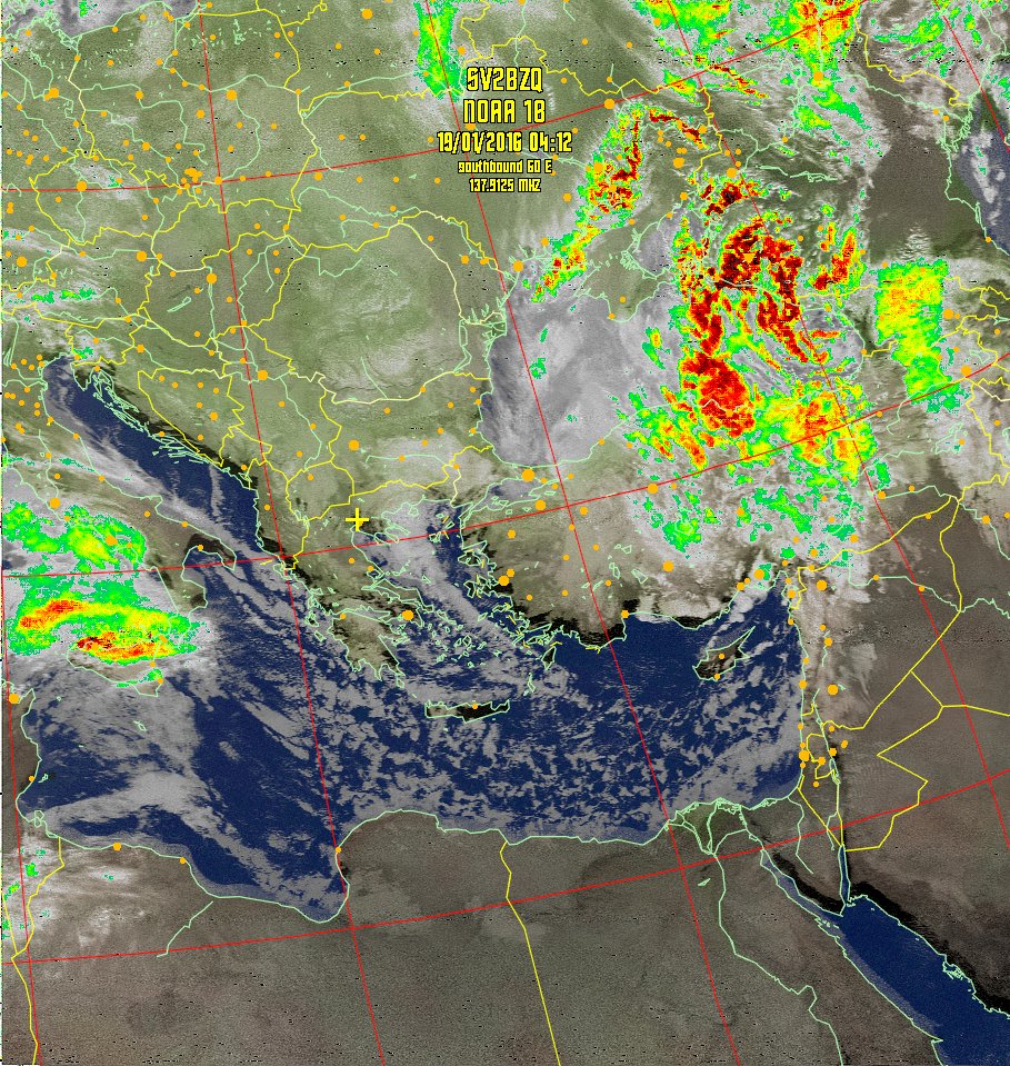
Daily Weather Satellite Images received in
|
|
Click on any image below for a full sized image.
Times are shown in ×ĺéěĺńéíŢ ţńá GTB.
Be sure to click "REFRESH" or "RELOAD" to get the most current images!
Table of Next Scheduled Satellite Passes over Thessaloniki, Greece
| Satellite | Start of Pass | Time Available | Maximum Elevation | Frequency | ||
| name | UTC | local time* | UTC | local time* | degrees (east or west) | MHz |
| NOAA 18 | 19 Jan 05:55 | 19 Jan 07:55 | 19 Jan 06:01 | 19 Jan 08:01 | 19° W | 137.9125 |
| NOAA 19 | 19 Jan 12:16 | 19 Jan 14:16 | 19 Jan 12:28 | 19 Jan 14:28 | 84° E | 137.10 |
| NOAA 15 | 19 Jan 14:32 | 19 Jan 16:32 | 19 Jan 14:40 | 19 Jan 16:40 | 25° E | 137.62 |
| NOAA 18 | 19 Jan 15:38 | 19 Jan 17:38 | 19 Jan 15:50 | 19 Jan 17:50 | 75° W | 137.9125 |
| NOAA 15 | 19 Jan 16:11 | 19 Jan 18:11 | 19 Jan 16:21 | 19 Jan 18:21 | 42° W | 137.62 |
| NOAA 19 | 20 Jan 00:39 | 20 Jan 02:39 | 20 Jan 00:49 | 20 Jan 02:49 | 37° E | 137.10 |
| NOAA 19 | 20 Jan 02:20 | 20 Jan 04:20 | 20 Jan 02:29 | 20 Jan 04:29 | 30° W | 137.10 |
| NOAA 18 | 20 Jan 04:01 | 20 Jan 06:01 | 20 Jan 04:11 | 20 Jan 06:11 | 47° E | 137.9125 |
* local time is ×ĺéěĺńéíŢ ţńá GTB.
|
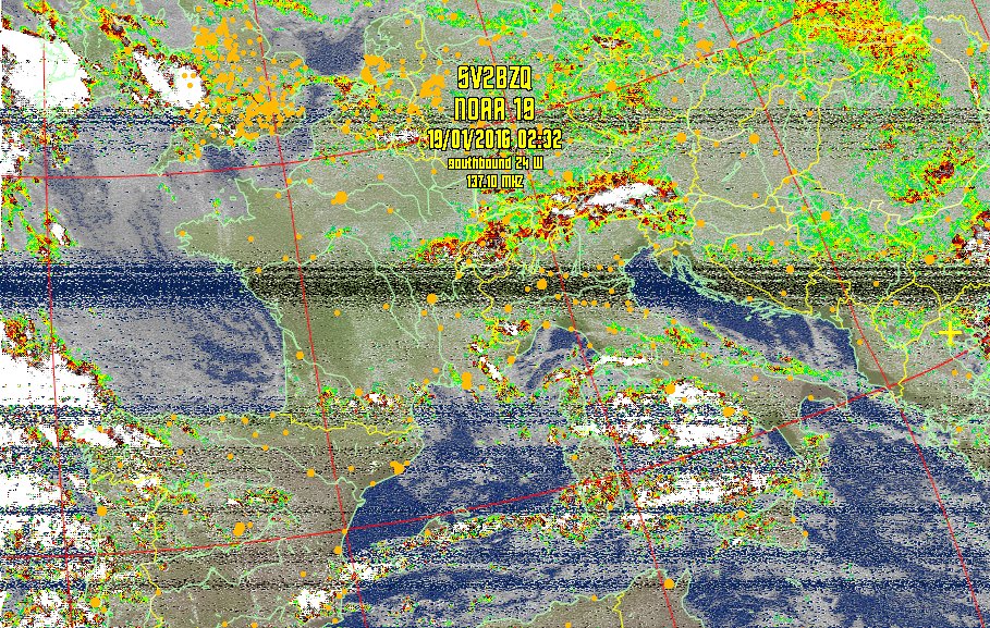
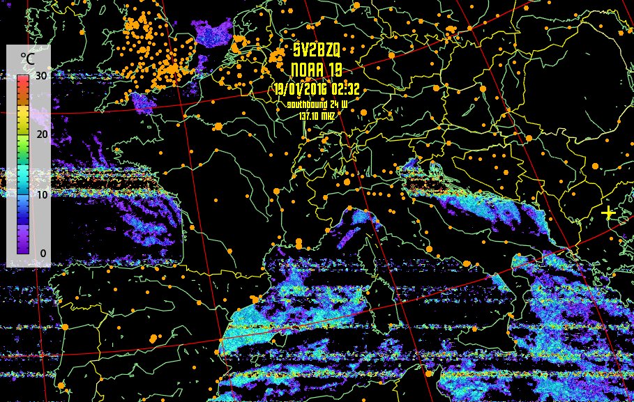
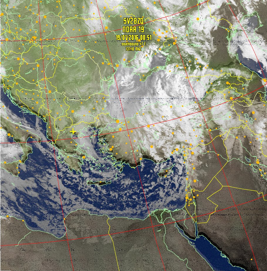
Satellite image key: |
|
HVCT = An Enhanced False color product with colored estimated precipitation areas. |
|
MSA-precip = Both Visual and IR channels combined (Multispectral) analysis with colored estimated precipitation areas. |
|
MCIR-precip = Map Coloured IR enhancement with colored estimated precipitation areas (used for nighttime passes). |
|
MSA = Both Visual and IR channels combined (Multispectral) analysis. |
|
MCIR = Map Colored IR enhancement (used for night time passes). |
|
SEA = Approximate Sea Surface Temperature derived during
nighttime passes. (Keep in mind that thin clouds will show up as colder
water temperatures giving false readings |
|
|
| Ground Station - SV2BZQ | |
|---|---|
| Location: | Ionia // Thessaloniki // Greece |
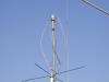
| Antenna: | Quadrifilar Helix Antenna (QHF) (my Antenna) |
| Receiver: | DF2FQ -- R2FX
|
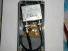
| Preamplifier: | (Photo) |
| Low Pass Filter 137 Mhz | (Photo) |
| Latitude: | 40.69 |
| Longitude: | 22.88 |
| QRA Locator: | KN10KQ |
| Altitude: | 35 meters |
|
Satellite |
Frequency (MHz)
APT |
Status |
Frequency (MHz)HRPT |
Status |
|
NOAA 12 |
137.500 |
off |
1698.0 |
on |
|
NOAA 14 |
137.620 |
off |
1707.0 |
on |
|
NOAA 15 |
137.500 |
on |
1702.5 |
on |
|
NOAA 16 |
-------- |
off |
1698.0 |
on |
|
NOAA 17 |
137.620 |
on |
1707.0 |
on |
|
NOAA 18 |
137.100 |
on |
1707.0 |
on |
|
NOAA 19 |
137.912.5 |
on |
-------- |
on |


 =>
=> =>
=> =>
=> =>
=>